
Trace a Roseburg Street
The most reliable Roseburg address trail moves from an address to the public record tied to that address. Start with the Douglas County assessment entry, not a name guess. Confirm the candidate by the physical address, map number, and legal description. The owner field is useful, but it identifies the assessed owner of a parcel, not everyone who may use that address. After the parcel is fixed, recorded deed parties and dated directory entries can test the connection. A voter record, where lawfully obtained through its formal route, is a separate and limited source.
Use the same order each time. It keeps the land record from being mistaken for a current household list and makes later results easier to check against the original custodian record.
- Enter the address in Douglas County Property Search, using fewer address words if a full entry does not return a candidate.
- Record the property ID or account, map number, current owner field, and full legal description. Keep the situs and owner mailing address in separate notes.
- Search the current owner as grantee through Clerk Recording Inquiry, then follow the prior grantor and matching legal description backward.
- For a voter-related question, use Oregon's formal SOS or county request process. My Vote is for an elector's own record, not an open street search.
- Ask the library or local historical repositories whether the relevant edition has a street or criss-cross section before using it to identify a past occupant.
Note: A matching street number alone is not enough when parcels, postal codes, or street labels have changed over time.
Roseburg Street Directory Property Search
Douglas County Property Search is the current-record entry point for a Roseburg address inquiry. Its public form uses one Search box rather than a verified street-browser control. The box accepts any combination of an address, tax lot ID, or property identifier. For a physical address, the county advises using the number and street name, then trying less information if the full address fails. An asterisk can stand in for the street number on vacant land. That supports a careful sequence of candidate review, not a promise of a complete street roster in one click.
| Property Search control | How to use it | Roseburg street-directory caution |
|---|---|---|
| Search | Enter an address, tax lot ID, or property identifier in the universal field. | A query is needed to return candidates. |
| Account or property ID | Include the alphabetic prefix, such as R12345. | Use it to return to the selected parcel. |
| Tax lot | Use township-range-section with dashes, such as 27-06W-13BB-00200. | It is a retrieval key, not a recorded legal description. |
| Physical address | Enter number and street name; reduce terms if needed. | No dedicated public street-browse button was documented. |
| Property Page selector | Open detail sections after choosing a property. | Read the fields as assessment data, not occupancy proof. |
| Bills tab | Moves to tax-payment information for a property account. | It is not a person-search feature. |
The property detail may show owner, property address, legal description, alternate account number, neighborhood, map number, property use, levy code area, districts, values, and related properties. Values and special assessment figures are tax data. They are not proof of a sale price or of personal occupancy. Public guest access is available, while some functions are restricted or disabled and separate paid data subscriptions exist. For an office route, the Assessor is at 1036 SE Douglas Ave, Courthouse Room CH206, Roseburg, with published Monday, Tuesday, and Thursday hours of 8 to 5, Wednesday hours of 8 to noon, and appointments otherwise.
Douglas County's public parcel-card example illustrates the property-detail layout used in an address search.
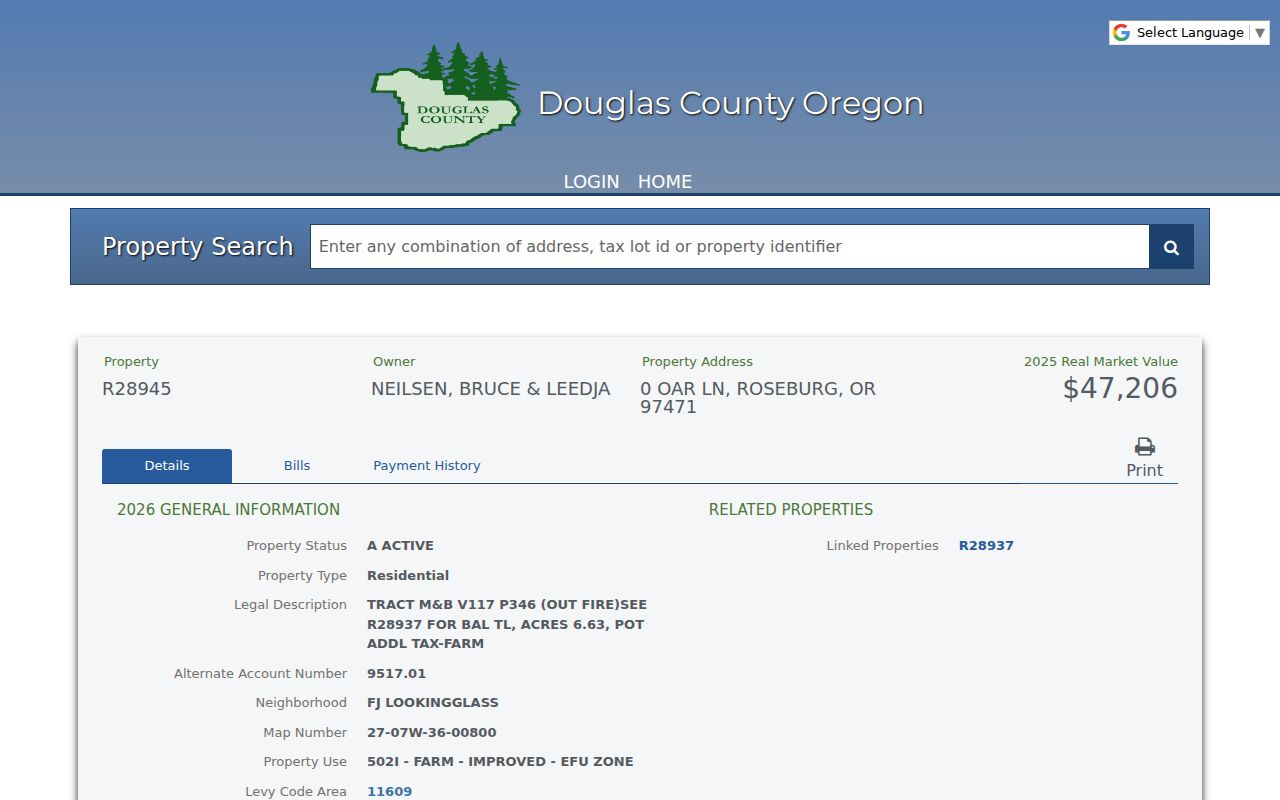
For a Roseburg parcel-card check, capture the parcel identifiers and compare them with the Clerk record, rather than treating one displayed owner field as a census of occupants.
Roseburg Parcel Address Meanings
A Roseburg parcel has several labels that answer different questions. The situs address is the physical location of the taxed land or building. The owner mailing address is where the assessment roll sends correspondence, and it can be a post-office box or another city. A property owner may be a co-owner, trust, or business. Neither field establishes that a particular individual occupies the physical address. Keeping those labels apart is especially important when comparing more than one property along a street.
| Parcel | A defined piece of land in the county assessment system. |
|---|---|
| Situs address | The physical location shown for the property, not a mailing or household record. |
| Plat | A recorded map that can show lots, blocks, subdivisions, and other legal land geography. |
| Criss-cross directory | A reverse directory arranged by address when an edition includes that section; its format must be checked in the actual volume. |
| Legal description | The recorded land identity, such as a lot and block, metes and bounds, partition parcel, or prior instrument reference. |
Douglas County says a tax lot, account, or assessor map number alone is not an acceptable legal description for recording. Carry the legal description, not just the street number, when moving to deeds. The distinction is a useful safeguard for people handling estate, family-history, or property-history questions where a similar address can otherwise lead to the wrong land record.
Map a Roseburg Street Segment
Douglas County GIS Map supplies the geographic half of a by-address search. Find Address accepts an address or part of one. Find Parcel accepts a name, property ID, map tax lot, or address and can work with multiple parcels. Select the target with Identify, then pan along the street and identify adjacent tax lots. Put each selected property ID back into the assessor search to see the public parcel detail.
The map can also show Assessor, Surveyor, Recreation, Elections, Sanitary, Planning, zoning, floodplain, and housepoint or driveway layers. Those layers help explain parcel context or civic geography. Election layers show boundaries and precinct context, not a voter roster. Measurements and markup help orient a street segment, but they do not create an ownership or occupant result.
County GIS Map Help shows the address, parcel, Identify, layer, and city-bookmark tools documented for the public mapping system.
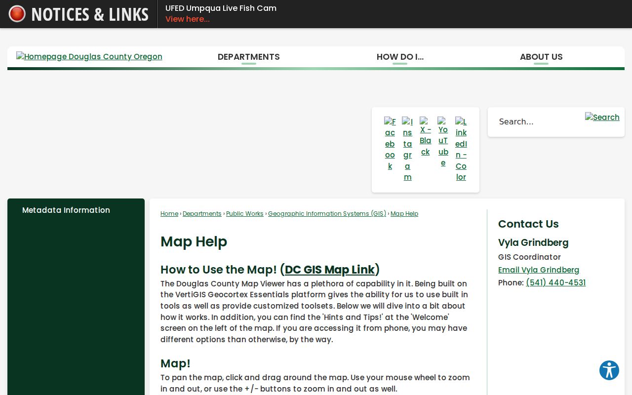
The map is a way to place parcels along a Roseburg street search. Boundary or title questions still need the recorded plat, survey, or deed record.
Note: No documented public GIS radius output identifies everyone living near a selected Roseburg address.
Roseburg Street Records by Address
Several Roseburg sources can be reached from an address, but each has a narrow role. The property roll is best for current assessed ownership and parcel details. GIS places a parcel beside other tax lots. The Clerk's records create an ownership chronology through parties and legal descriptions. City files can add project or enforcement context when released. A voter list and an older directory are limited, dated corroboration sources, not replacements for any of the other records.
| Address-linked source | What it can add | Roseburg access and limit |
|---|---|---|
| Assessor property roll | Current owner, situs and mailing fields, account, map, legal description, value, and district data. | Public property search or Assessor office; current assessment data, not a full occupancy history. |
| GIS and survey map | Parcel location, adjoining tax lots, roads, zoning, flood, district, and subdivision context. | Public map tools; map boundaries are informational, not a title determination. |
| Recorded deed and index | Grantor, grantee, document date and identifier, plus legal-description chain. | Older name indexes and archive routes; some newer image access requires subscription or a copy request. |
| City permit, planning, or code file | Address or project context when a releasable record exists. | No verified open City permit search; submit a detailed written request. |
| Oregon voter list | Statutorily public elector fields where lawfully supplied. | Formal request only, with exclusions and use limits. |
| Historical directory | Past occupant or business lead if the inspected volume has a street section. | Confirm the edition, holding, and section before relying on it. |
A street name links the research steps, but the legal description joins the land records. The current street tool and public maps are useful for geography. They do not turn property and civic records into a complete list of present residents.
Roseburg Deeds Beyond Street Names
Street names are not a durable deed-index key. In Douglas County, begin with the selected assessor result, then use the current owner as grantee in the Clerk index. Capture the recorded date, document or instrument number, document type, prior grantor, and legal description. Search that former grantor as grantee for the earlier acquisition, repeating the process while the legal description stays consistent. A lot, block, subdivision, metes-and-bounds, or partition description survives changes that can confuse a street-only search.
The Clerk Recording Inquiry gateway directs researchers to the newer and older pathways. The documented older direct and indirect property indexes cover 1990 and older and do not provide images in that route. Subscription access covers index and images from 1992 through yesterday, with document images by instrument number back to 1965. The overlap reflects different access routes and media, not one single online coverage range. The live application field list was not verified, so party names, era, and recorded identifiers are the sound search mechanics to rely on.
Douglas County Clerk Recording documents its inquiry and copy channels.
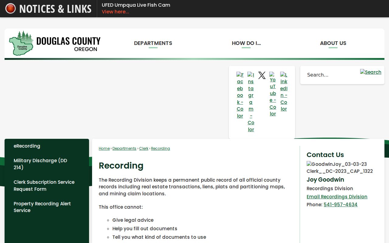
When the online path stops, copies are available by mail or email, with phone orders accepted by card. Researchers can also use the recording counter or call the Clerk Archive before a visit. The Archive holds deeds from 1853 to the present and accepts call-ahead visits, written requests with payment, and phone orders. The Recording Division does not conduct genealogical research by email or phone, so a request to Archives should name the person, record type, date range, and known book, page, or instrument number.
Note: The Clerk's stated fees distinguish a copy request or certification from an online index search result.
Roseburg Voter Requests by Street
Oregon My Vote lets an elector check, view, or update that elector's own registration and ballot information. It is not a public name-and-address browser. A by-street voter lookup was not verified for Roseburg or Douglas County. A lawful researcher must use the official voter-list request process instead, understanding that a requested file cannot establish every person at an address and is not a casual street roster.
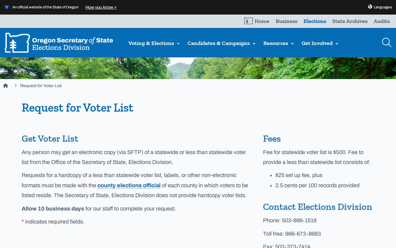
Oregon's voter-list request page describes electronic lists delivered through SFTP. A statewide electronic list costs $500; a less-than-statewide electronic list carries a $25 setup charge plus 2.5 cents per 100 records, and the state allows ten business days. For hardcopy, labels, or other non-electronic less-than-statewide requests, contact Douglas County Elections. The agency can only provide geography and format within its capability.
The official request screen is the proper starting point for the formal voter-file route.
ORS 247.948 allows specified public elector fields, subject to protections. The public portion can include party affiliation, residence or ballot-mailing address where not protected, birth year, precinct information, telephone number, voting-history indicator, and election-period ballot status. It does not provide ballot choices, full birth date, Social Security number, driver-license number, or copied signature. ACP participants and other protected voters are excluded, and ORS 247.955 restricts commercial use of elector-list information.
Roseburg Permit Record Requests
City permit, planning, code, and enforcement material can add a dated address record when it exists and is releasable. No official open Roseburg permit or code search was verified. The appropriate fallback is a written request to the City Recorder under the City's policy, not an assumption that a name or street can be searched online. Community Development can help identify address-specific land-use or code context, but a project file does not establish a household.
The City request form requires the requester's name, mailing address, email, telephone number, signature, request date, a detailed description, and a brief purpose statement. Include the address, approximate year, known owner or parcel identifiers, department, and whether inspection, an ordinary copy, or a certified copy is needed. The City does not have to create a record or a new computer extract. It may estimate charges for locating, reviewing, redacting, and separating records before release.
The Roseburg policy cites ORS 192.410 through 192.505. It calls for acknowledgment in five business days where practicable, then completion or a written continuing-work notice with a reasonable estimate within ten business days after the acknowledgment deadline. The county written-request process likewise asks for the office, known document, and date span. Those routes preserve a request when an address portal has no matching record.
Roseburg Road Directory Limits
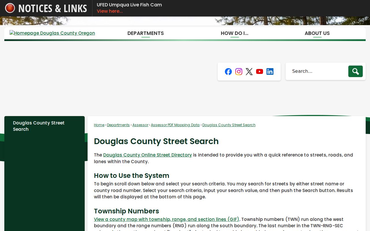
Douglas County Online Street Directory searches a street name or county road number. It is valuable for normalizing road geography before an assessor, GIS, or deed search. It is not a resident roster, and its result cannot identify everyone associated with an address. The County GIS Find Road, Find Address, Find Parcel, and Roseburg city bookmarks are the companion tools for locating the correct physical area.
The County street and road directory shows the road-reference service that supports this first geographic check.
Once a road name is normalized, move back to the parcel and deed process. The road directory does not replace the address-specific records held by the Assessor, Clerk, City, or Elections office.
Roseburg Postal Address Geography
Roseburg street research also crosses postal geography. The USPS Office of Inspector General reports that the Roseburg Main Post Office serves ZIP Codes 97470 and 97471, but that delivery area is not the same as the City of Roseburg boundary. A Roseburg mailing city or ZIP therefore does not establish municipal jurisdiction. Use the assessor and GIS for parcel context, and use USPS ZIP Lookup for the mailing ZIP of a specific physical address.
The 97471 delivery area was established in 2008 for 12,730 deliveries that had used 97470. An older deed, directory, or letter with 97470 may concern land whose current delivery ZIP is 97471. That postal change does not itself show that the property moved or that the street number changed. Charter Oaks is a local example of the same need to separate geography: the City's 2024 urban-growth-boundary action describes properties partly in or out of the City and UGB, including a 220-acre addition and related deannexation process. The recorded legal description, historic maps, and the original record date are stronger anchors for an address trail.
Historic Roseburg Street Leads
For a past occupant question, first ask whether a specific historical directory edition contains a street or criss-cross section. Roseburg publications documented in preservation sources include 1909-10, 1921-22, 1938, 1946, 1948, 1950, and 1954-55. The citations verify those publications, not that any one local shelf presently holds every volume or that every edition has the same arrangement. Roseburg Public Library, the Genealogical Society of Douglas County, the Douglas County Historical Society, and the Clerk Archive are the appropriate places to confirm a holding and access conditions.
Request the exact year, surname, address, and whether an alphabetical or street section is needed. If an edition is available, transcribe its own abbreviation key before interpreting a notation. For a longer historical address trail, the documented collection routes and volume limits are covered in the Roseburg directory book. Pair a dated directory entry with a deed, census, newspaper, or probate record rather than treating it as unqualified proof of residence.
Note: A historic street entry is strongest when its publication year and address format agree with an independent local record.
Roseburg Street Privacy Limits
A Roseburg address search cannot reveal every current occupant. Assessor records identify assessed ownership and mailing or situs fields, not all people connected to a property. GIS shows parcels and boundaries, not utility customers or DMV address data. A historical directory is dated and edition-specific. Voter information has statutory exclusions, and the County Archive reports that voter registrations were purged before 1993. A public record can be useful evidence without being a complete household account.
Oregon's Address Confidentiality Program provides a substitute address and mail-forwarding service for qualifying survivors and certain covered health-care providers. Voter residence protections also apply in specified circumstances. Protected data, confidential material, and records that are not held by the custodian remain outside a street search. The safest practice is to seek a narrow official record for a lawful personal purpose, verify it with the custodian, and stop where privacy protections apply.
Lawful use. Roseburg street and address records are for lawful personal research and property history. Do not use a record to stalk, harass, threaten, or harm another person.